{{ ln.tipo }}{{ ln.dal }}
{{ ln.nome }}
{{ ln.sintesi }}
{{ ln.qui }} · {{ ln.fonti }}
- {{ fm.n }}
From the crossroads · transport
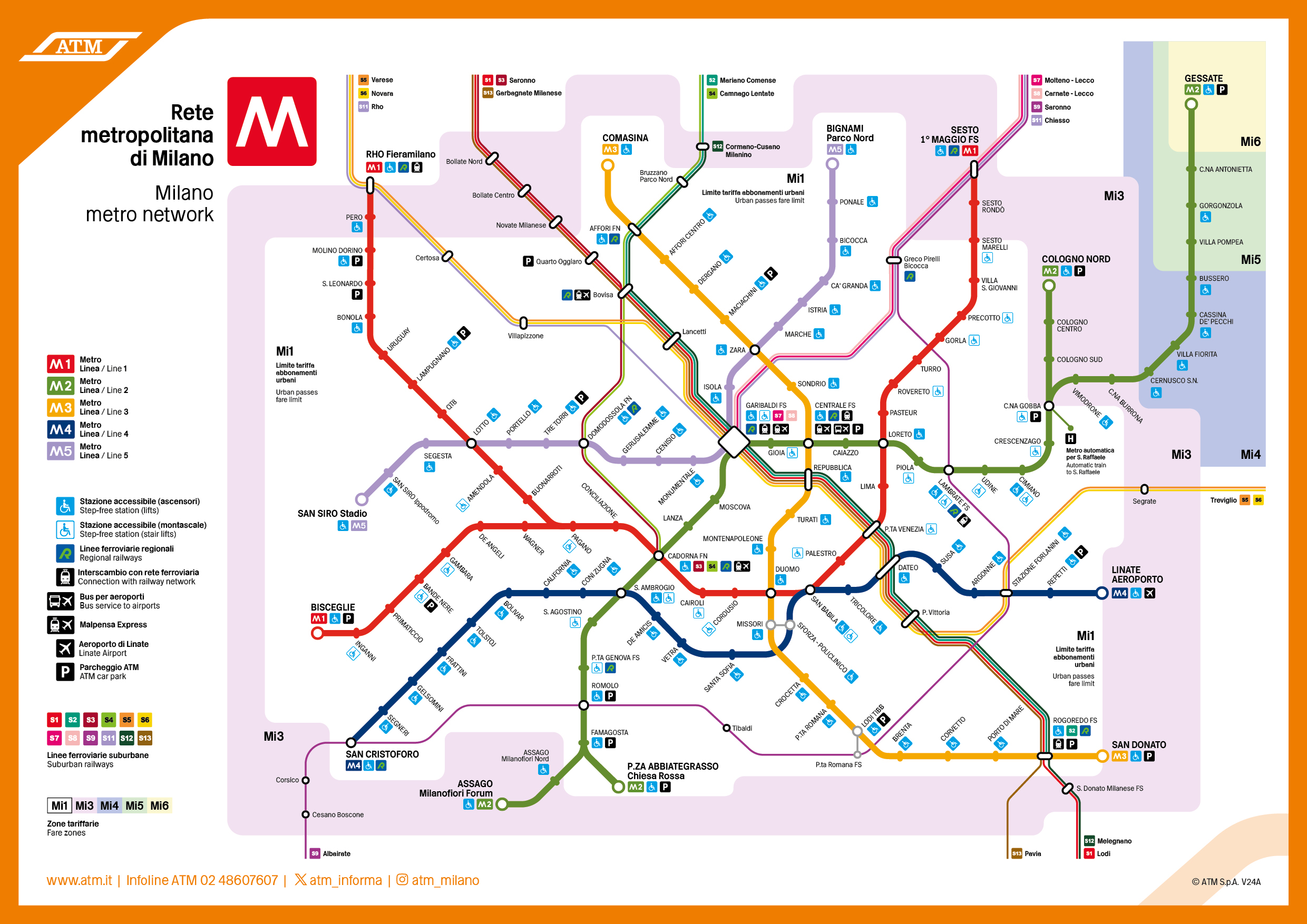
The crossroads lies between two metro lines: the M5 to the north, under the stadium, and the M1 on either side of the area. In between run tram 16, buses 49 and 80, and further east the 90/91 circle line. Here each line with the stops that serve the area.
ATM · network status
{{ atmQuando }}
No ATM notices on the area’s lines.
Lines followed: M1, M5, tram 16, buses 49, 64, 78, 80, 90 and 91. Status is read from ATM’s public page twice a day; for real time use ATM’s infotraffic.
Getting here
Each row is a journey: read it from left to right. The colour is the line’s. The last box says how far is left on foot, to the stadium and to the crossroads.
From
{{ ar.da }}
Get off at
{{ ar.scendi }}
{{ ar.piedi }}
{{ cs.k }}
{{ cs.t }}
By car
On match and concert days the streets around the stadium have restricted areas, checks and diversions. The sources advise against looking for a space in the streets near the Meazza and recommend leaving the car at a park-and-ride on the metro.
{{ au.k }}
{{ au.t }}
{{ au.x }}
The stops, from the satellite
The lines
{{ ln.sintesi }}
{{ ln.qui }} · {{ ln.fonti }}
Chart
Straight-line distance from the crossroads of via Novara and via San Giusto to the square of each station, from the page’s coordinates Streets. On foot the route is longer. Bus 49 stops at the crossroads itself.
Diagram
The most direct route, stop by stop.
Video
29 April 2015: the Garibaldi–San Siro Stadio section opens to the public.
San Siro Stadio · M5
The M5 terminus was built for the stadium. Outside the station, under a large metal canopy, a row of full-height turnstiles operates only on event days: it lets the crowd in by groups, so the platforms do not overfill.
After the match, on the order of the Questura, the M5 stations San Siro Ippodromo and Segesta may stay closed: those leaving the stadium use San Siro Stadio or walk to Lotto (M1), about a quarter of an hour.
Changing at Lotto
On event days the corridor between M1 and M5 may be closed. You exit through one line’s turnstiles and re-enter through the other’s: the same ticket is valid.
By bicycle
On via Achille, north of the stadium forecourt, there is an area with bicycle racks.
On match days
Source: official ATM notice. The day’s timetables are on ATM’s website; the matches in the calendar.
2026/27 season
Sources: official note from Inter and Milan for the 2026/27 season; Corriere dello Sport, Calcio e Finanza, MilanoToday. Each person’s gate is on their ticket.
History
Video
The Milan–Magenta steam tram ran along the road to Novara; its last run was on 31 August 1957. YesMilano retraces its route from Porta Vercellina to Magenta.
Under construction
From the photo collection
All records in the photo collection.
Where it continues
Once you arrive, water kiosks, recycling point, San Carlo hospital, Biblioteca Harar and the Municipio 7 offices are in Services around the crossroads.
Sources for this page
Routes and stops from ATM and from the encyclopedia entries for the stations. Station positions are measured on OpenStreetMap and on the Esri imagery.
What this page rests on
Two independent sources
Dates, measurements and names go through at least two sources that do not copy each other. Where it exists, we go to the original: the deed, the archive, the body that owns it. What appears in only one place waits.
One version only
If two sources disagree, the original document prevails. If even that is not enough, only the part they agree on is written: the year, for example, instead of the day.
Updated every day
The press review and calendar are updated every day. Everything else changes when a new document turns up, and then it changes everywhere at once.
From the community
Many memories, family photographs and tips come from people who live here, writing to the Facebook page. They are published only if the sender agrees. How to take part: Community.
Everything traceable
Sources are listed above and on the page Sources, with archive, shelfmark and terms of use.
No interpretation passed off as fact
An approximate figure stays approximate, a project stays a project until construction starts, and whatever does not add up stays out. The criteria are in Method.