
Around the stadium
Around the stadium,
on foot from the crossroads
The stadium stands six hundred metres north of the traffic light at via Novara and via San Giusto. Around it, on foot, are five places that tell the story of the area: the road of the crossroads, the neighbourhood between the two streets, the church that gives everything its name, the Horse at the racecourse entrance and the hill of Monte Stella. For each place the distance is measured from the crossroads.
01 · 0 m · The crossroads
Via Novara, the road of the crossroads
The traffic light stands on via Novara. The road starts in piazza Melozzo da Forlì, 1.1 km to the east, and reaches the Settimo Milanese boundary after thirty-one side streets. It is the old road to Novara and Vercelli: with law no. 1094 of 17 May 1928 it becomes state road 11, the Padana Superiore. From 2 August 1879 to 31 August 1957 the Milan–Magenta steam tram, the Gamba de Legn, runs along it.
The Harar neighbourhood begins at the north-east corner of the crossroads. Westwards the road passes Quarto Cagnino, Quinto Romano and Figino and leads to the Trenno and Cave parks and to Boscoincittà. At number 139 is the Gelateria Floriana, open since the 1950s and listed in the City's register of historic shops.
- Side streets
- 31
- State road 11
- 1928
- Gamba de Legn
- 1879–1957
02 · 0–480 m · North-east of the crossroads
The neighbourhood between the two streets
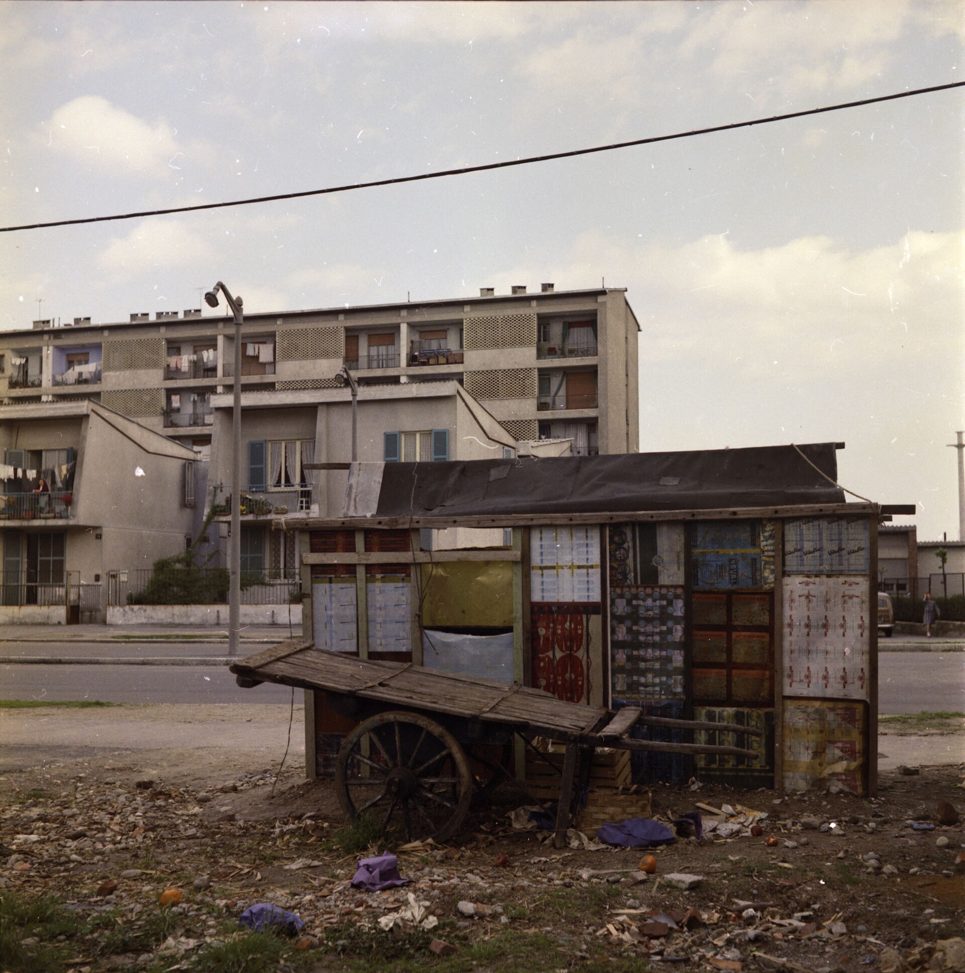
The Harar-Dessiè neighbourhood is enclosed by via Harar, via Novara and via San Giusto. It is built from 1951 to 1955 under the INA-Casa plan of the Fanfani law, to a master plan by Gio Ponti, Luigi Figini and Gino Pollini: about nine hundred and forty homes, split between the «horizontal skyscrapers», five-storey linear blocks, and the «insulae», two-storey houses grouped in small blocks.
At via Albenga 2 is the Harar library: it opens in 1951 as the neighbourhood's community centre, has been a library since 1966 and has a local history section. Walking up via San Giusto, 480 metres from the crossroads, you reach piazza Axum, with the M5 San Siro Stadio station and the tram 16 terminus. Further east, in the San Siro public housing neighbourhood, are the covered municipal market of piazzale Selinunte, from 1957, and the street markets of via Zamagna and via Osoppo. On via Novara, at number 139, is Gelateria Floriana, open since 1954 and listed in the City’s Register of historic shops: the historic-shop plaque was designed by Bob Noorda. The parish of Beata Vergine Addolorata in San Siro, Ambrosian rite, is at piazza Esquilino 1. Alcione, a football club founded in 1952, plays at the Kennedy ground in via Olivieri, behind Parco delle Cave: its story is on the Other teams page.
- Construction
- 1951–55
- Homes
- ~940
- Selinunte market
- 1957
03 · 900 m · North-east of the crossroads
The church that gives the area its name
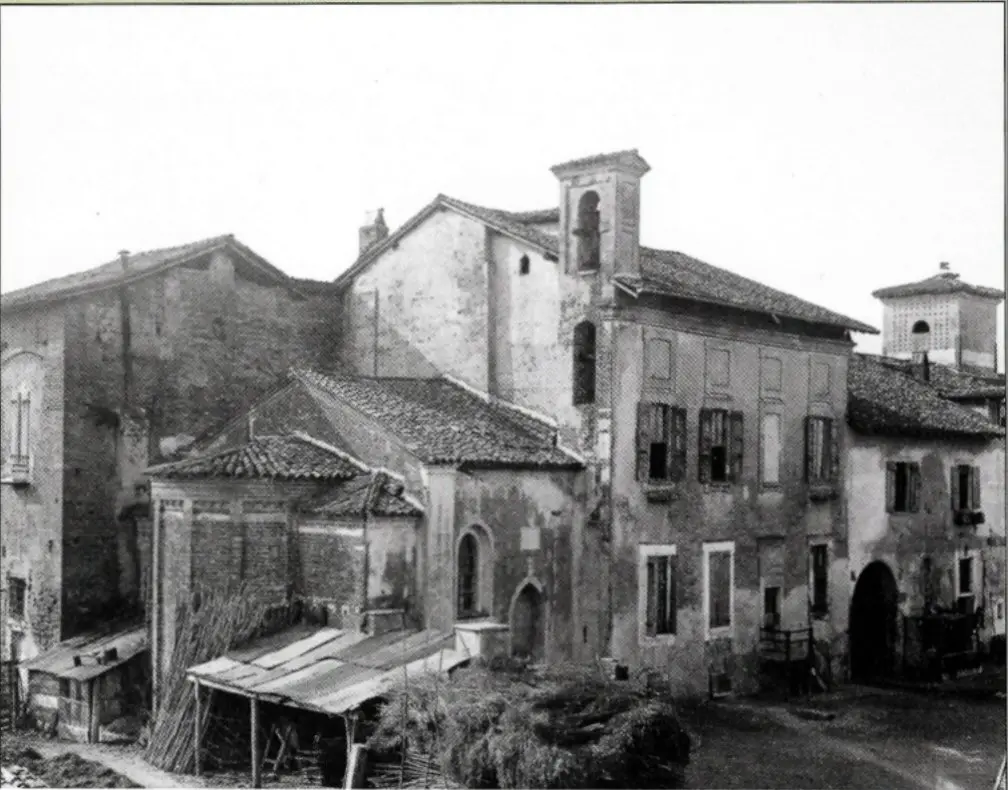
San Siro alla Vepra stands at via Masaccio 20. The church is recorded in 885, rebuilt in the fifteenth century and a national monument since 1911. The area takes its name from here. Saint Syrus is celebrated on 9 December.
- First record
- 885
- National monument
- 1911
- San Siro
- 9 December
04 · 1.3 km · North-east of the crossroads
The Horse at the racecourse entrance
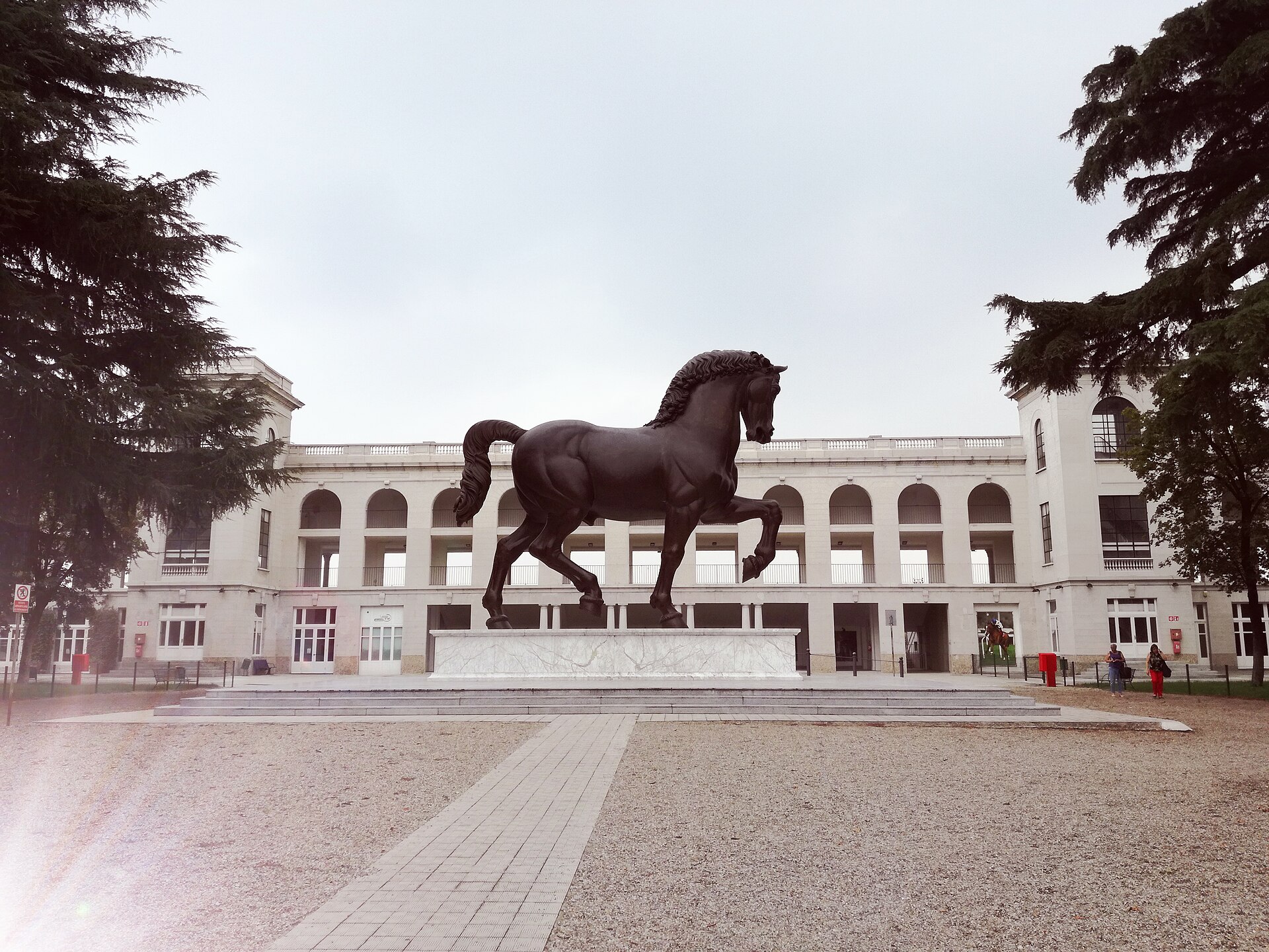
Leonardo's Horse stands at piazzale dello Sport 6: Nina Akamu's bronze from the drawings Leonardo made for the monument to Francesco Sforza, commissioned by Ludovico il Moro in 1482. It has stood at the racecourse entrance since 10 September 1999. It is seven metres tall and weighs ten tonnes.
Behind it is the Galoppo racecourse, opened in 1920 with the Art Nouveau stands by Paolo Vietti-Violi; the trotting track next door opens in 1925. The Horse area is open every day from 10 to 19, free of charge.
- Commission
- 1482
- The bronze
- 1999
- Galoppo
- 1920
05 · 2.3 km · North-east of the crossroads
The rubble hill and the Garden of the Righteous
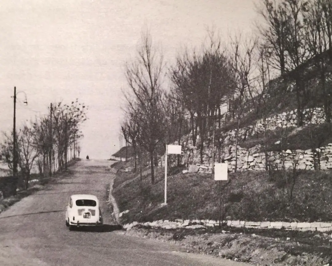
Next to Piero Bottoni's QT8 is Monte Stella, the hill built from war rubble: forty-five metres above the plain, 311,200 m² of park. Since 2003 it has hosted the Garden of the Righteous of the World, with a tree and a stone for those who opposed genocide and persecution. 6 March is the Day of the Righteous, a civil commemoration since 2017.
- Height above the plain
- 45 m
- Garden of the Righteous
- 2003
- Day of the Righteous
- 6 March
From the satellite
The five places, from above
The SS mark is the crossroads. To the north the stadium; to the north-east the Vepra, the Horse and Monte Stella. All maps.
Video
The Gamba de Legn and the Horse
Where it continues
- From the crossroads to the stadium on foot, in Transport.
- Matches and concerts, in the Calendar.
- The point everything is measured from, in The crossroads.
Sources for this page
The full directory of official sources, with the selection criteria, is in Method.
What this page rests on
Every fact is checked against at least two independent sources and, where one exists, the official source.
Two independent sources
Dates, measurements and names go through at least two sources that do not copy each other. Where it exists, we go to the original: the deed, the archive, the body that owns it. What appears in only one place waits.
One version only
If two sources disagree, the original document prevails. If even that is not enough, only the part they agree on is written: the year, for example, instead of the day.
Updated every day
The press review and calendar are updated every day. Everything else changes when a new document turns up, and then it changes everywhere at once.
From the community
Many memories, family photographs and tips come from people who live here, writing to the Facebook page. They are published only if the sender agrees. How to take part: Community.
Everything traceable
Sources are listed above and on the page Sources, with archive, shelfmark and terms of use.
No interpretation passed off as fact
An approximate figure stays approximate, a project stays a project until construction starts, and whatever does not add up stays out. The criteria are in Method.